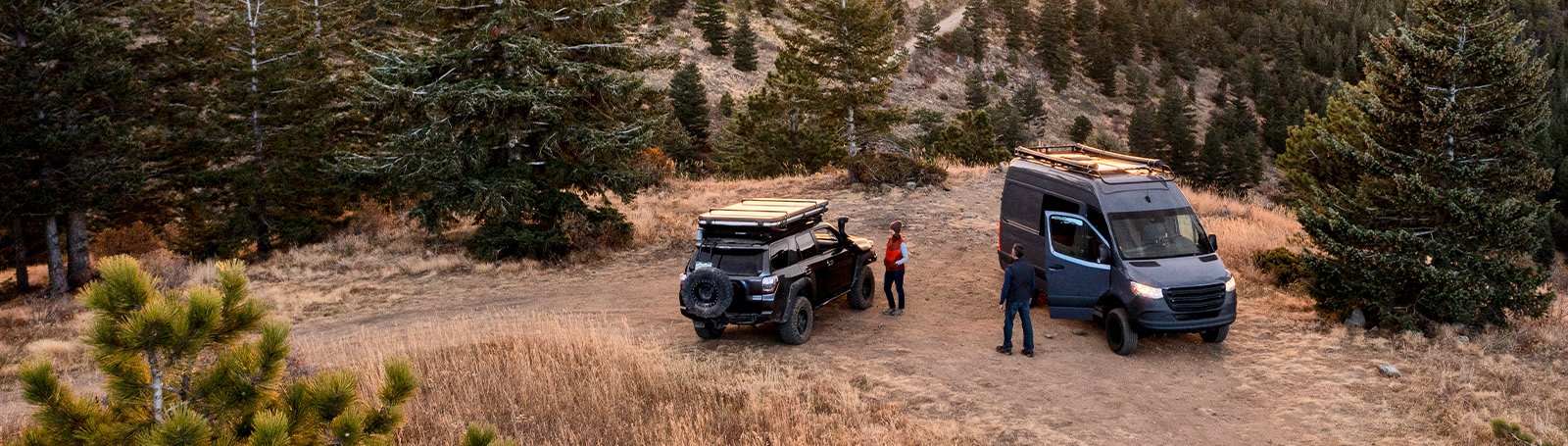
Go into the unknow
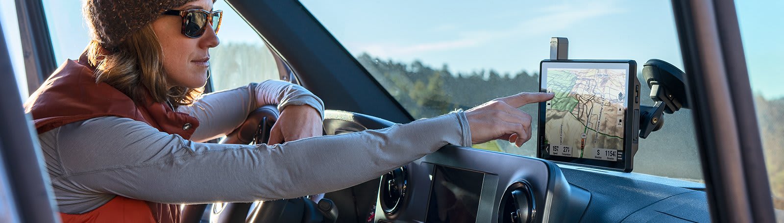
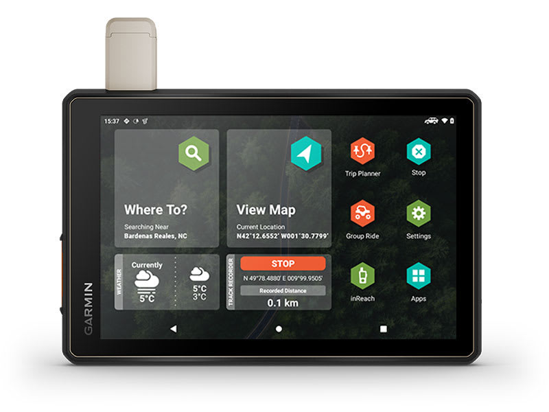
This rugged and extra-large satellite navigator was built for every step of the journey and has route tracking maps and communication technologies to keep you connected on the trail.
Made for upcoming journeys.
OFF-ROAD RUGGEDNESS
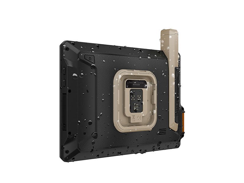 |
This Tread device is a specialist equipment adapted to work in the field – it can cope with all conditions and is waterproof in class IP67. |
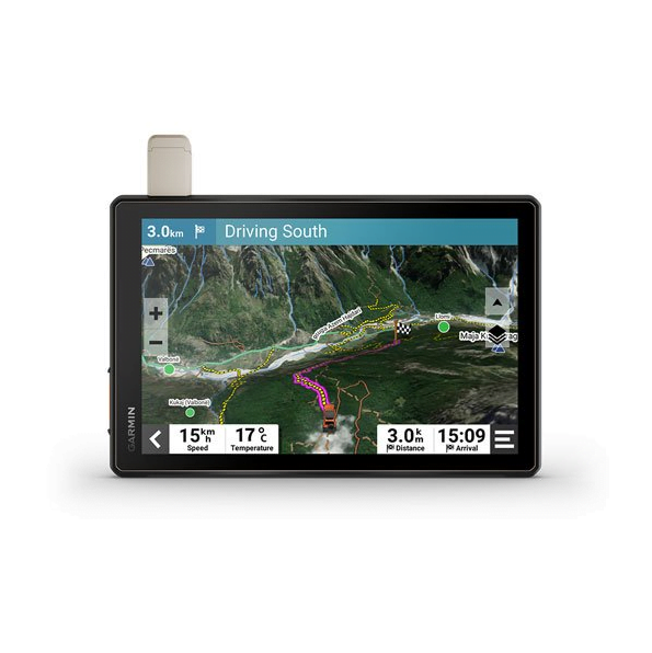
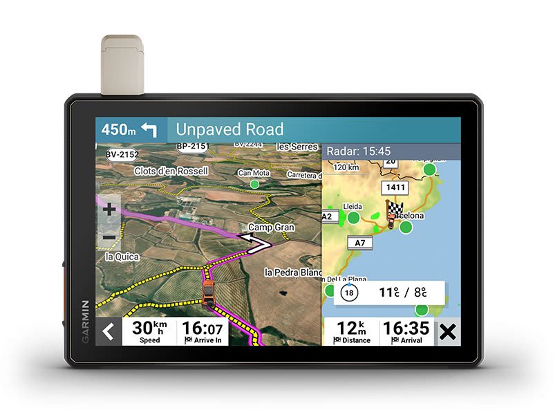
HIGH-VISIBILITY DISPLAY
| The ultra-bright display of the satellite navigation system with a 10″ touchscreen, which can be operated with gloves, is built to be visible even in the sun or in complete darkness. The device can be installed vertically or horizontally. |
 |
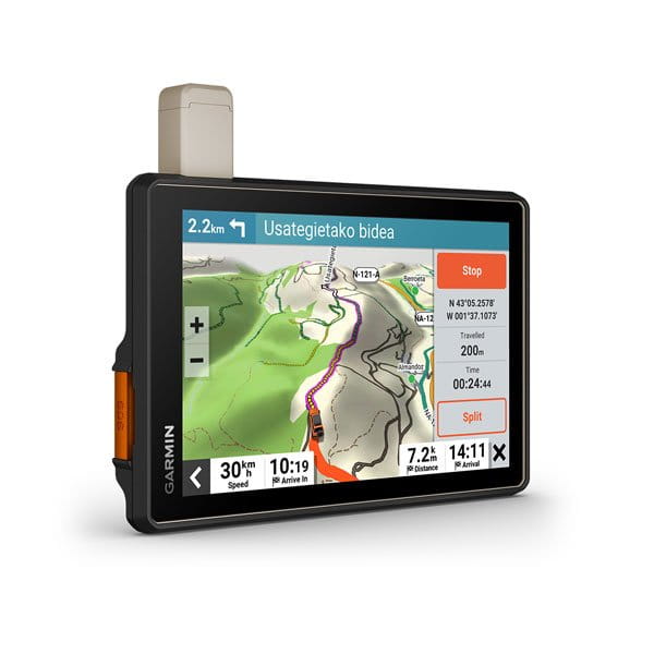
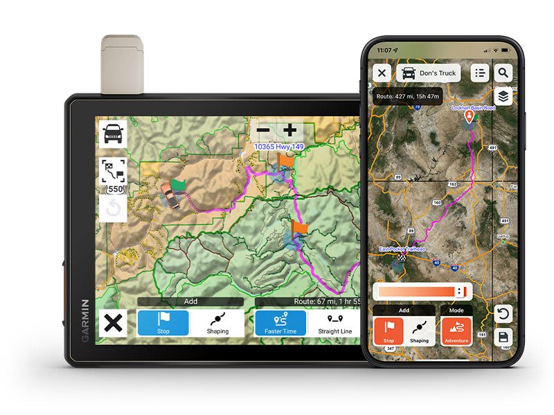
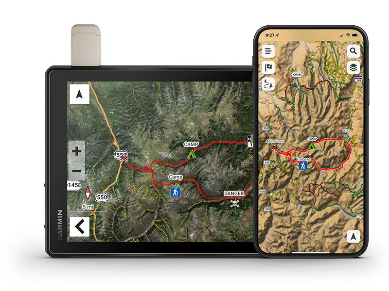
TRAIL NAVIGATION
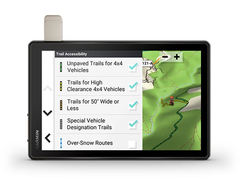 |
With detailed navigation, you will navigate1 dirt roads and trails using road maps and hiking trails made up of OSM maps. |
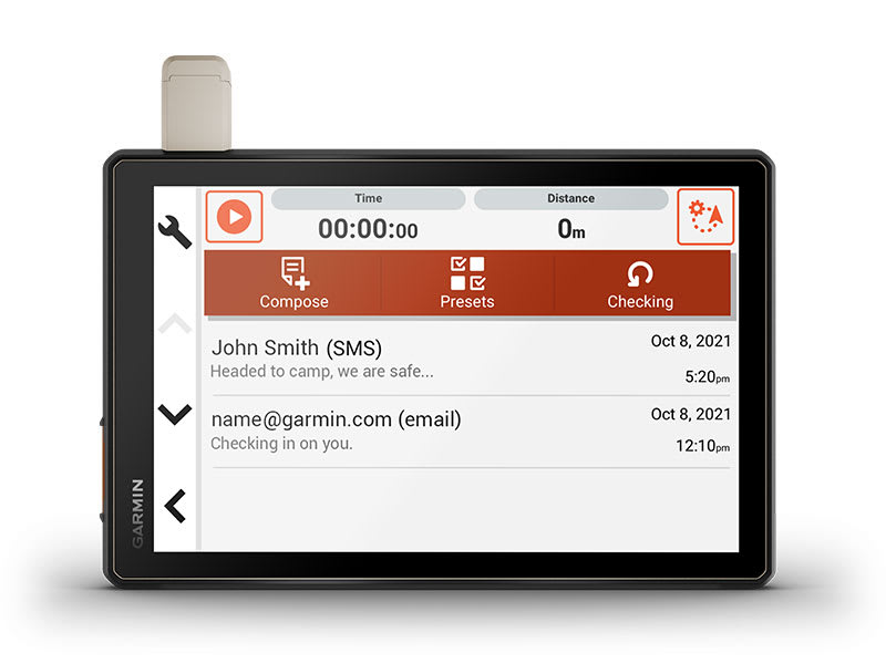
BUILT-IN INREACH TECHNOLOGY
| Built-in inReach technology enables global satellite communications, two-way text messaging, location sharing, interactive SOS signaling and weather forecast updates4. |
 |
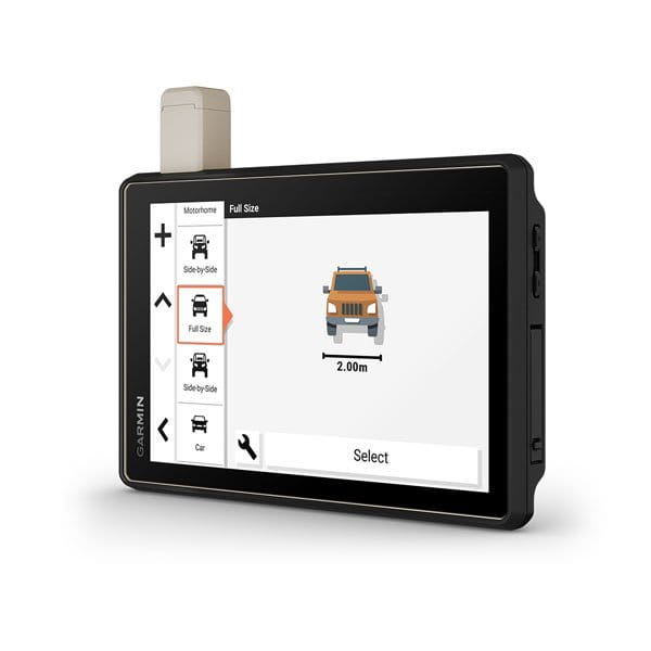
MAPS ON AND OFF-ROAD
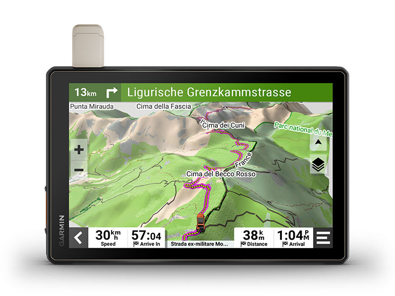 |
Tread features preloaded topographic maps with 3D terrain and street maps for Europe, Africa, including Tracks4Africa, and the Middle East. It also includes detailed street maps of Europe with routing adapted to the size and weight of the vehicle2. Maps for North and South America, Australia, and New Zealand are available for free download at garmin.com/express. garmin.com/express.u. Mapy Ameryki Północnej i Południowej, Australii i Nowej Zelandii są dostępne do bezpłatnego pobrania pod adresem garmin.com/express. garmin.com/express. |
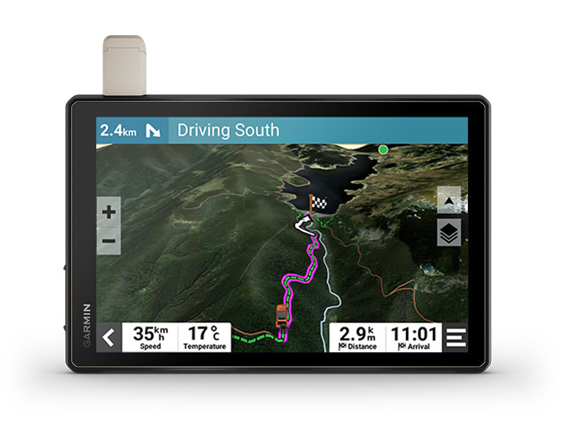
SATELLITE IMAGERY
| Enjoy realistic aerial by downloading high-definition BirdsEye satellite imagery directly to your device via Wi-Fi® without the need for an annual subscription. |
 |
POINTS OF INTEREST
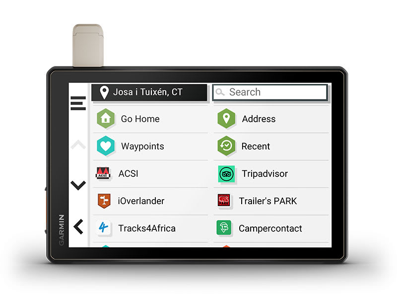 |
Pre-installed iOverlander, ACSI ™, Campercontact ™ and Trailer’s PARK ™ points of interest will help you find the best-located, remote and scattered campsites without using a cell phone signal. |
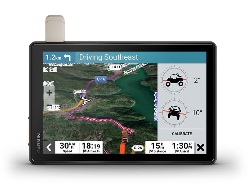
ABC SENSORS
| Built-in sensors (altimeter, barometer, compass and longitudinal / lateral tilt indicators) will keep you in control when driving over rough terrain. |
 |
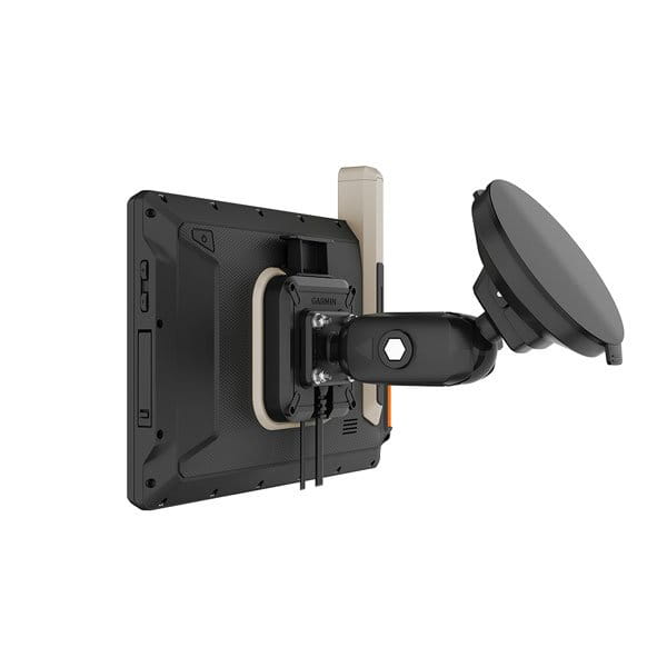
SECURE MOUNT
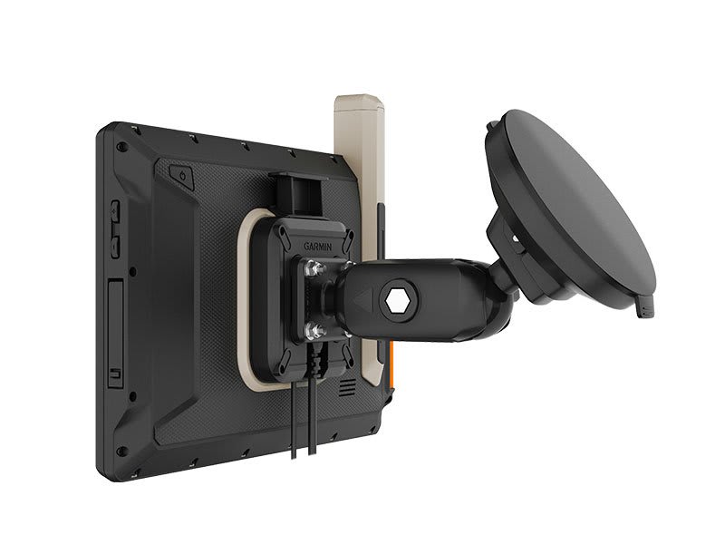 |
The included magnet assist lockable mount will securely attach the Tread device to your motor vehicle. |
Connect for a better adventure.
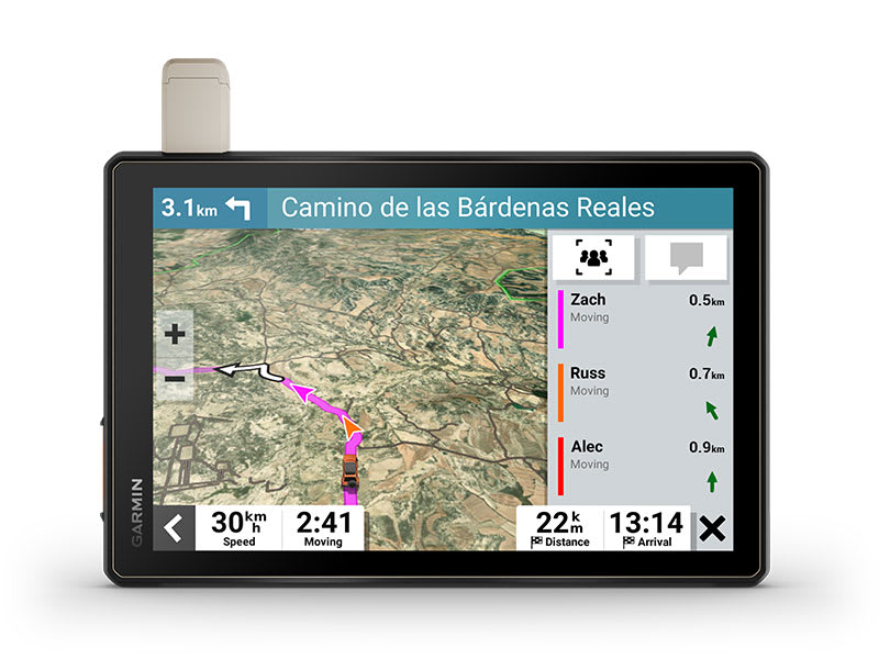
GROUP RIDE MOBILE
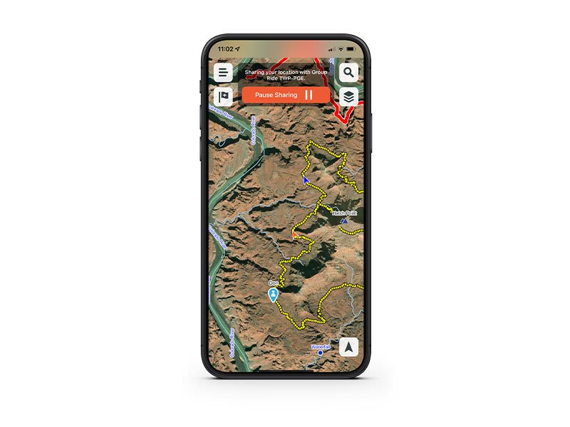 |
You can follow your friends on a compatible smartphone or Tread device when you use Tread’s group ride feature with them3. |
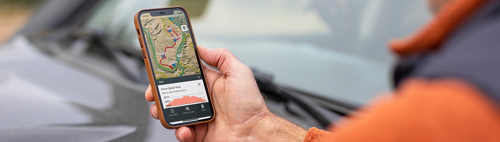
EASY ROUTE PLANNER
| Tread app provides easy route planning using the same maps, vehicle profiles, and route preferences available on your device. |
 |
EASILY SYNC YOUR DEVICES
 |
Sync your waypoints, tracks, routes and collections across all your devices. It is also possible to easily import and share GPX files. |
LIVE WEATHER
| The changeability of the weather will not surprise you anymore! You can easily pair your Tread device with a compatible smartphone and download the Tread app to access real-time weather information, storm alerts, animated radar and more. |
 |
Overlanding equipment for expeditions.
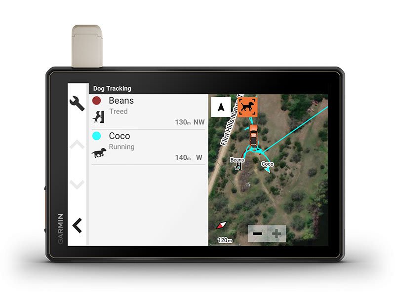 |
The Tread device can also be wirelessly paired with select Garmin GPS dog trackers (sold separately) to make it easier to track and recall your sporting dogs in the field. Markers for each dog within tracking range appear as an overlay on the nav’s map screen. Direction guidance helps you locate and track your dog’s position. |
CONTROL YOUR ACCESSORIES
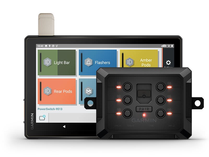
| Pairing with a compatible Garmin PowerSwitch ™ digital switch box (sold separately) will allow you to control 12-volt vehicle accessories – such as lighting strips or differential locks – directly from the device screen. |
 |
GROUP RIDE TRACKER
 |
Pair your device with a compatible Group Ride Tracker (sold separately) for group ride tracking and saved messages. |
IN THE BOX:
- Tread® XL – Overland Edition,
- Suction cup mount,
- Vehicle power cable,
- Locking magnet-assisted mount,
- USB-C cable,
- Documentation.
1 Limitations may exist in map data for some road and trail route suggestions. Always defer to all posted road signs and conditions during vehicle operation. The Garmin OpenStreetMap products are intended to be used only as a supplementary travel aid and must not be used for any purpose requiring precise measurement of direction, distance, location or topography.
2 Not available in all areas. Entering your vehicle’s profile characteristics does not guarantee your vehicle’s characteristics will be accounted for in all route suggestions. Always defer to all posted road signs and road conditions.
3 Tracking via Group Ride Mobile requires the Tread app running on your and each friend’s compatible smartphone with Bluetooth® technology and an active mobile phone connection.
4 Active satellite subscription required for the inReach features. Some jurisdictions regulate or prohibit the use of satellite communications devices. It is the responsibility of the user to know and follow all applicable laws in the jurisdictions where the device is intended to be used.
5 Group Tracking is available for riders using a Tread sat nav, and only riders with a Tread sat nav may be tracked. Connection to vehicle power is required for group tracking functionality.
Copyright © 2022 by iOverlander, LLC. Satellite Imagery © 2021 Maxar Technologies (date of satellite imagery may vary). Wi-Fi is a registered trademark of the Wi-Fi Alliance. The Bluetooth word mark and logos are registered trademarks owned by Bluetooth SIG, Inc. and any use of such marks by Garmin is under license. ©2021 ACSI Publishing B.V. All publishing rights reserved. NKC campercontact data: ©2021 Nederlandse Kampeerauto Club “N.K.C.”